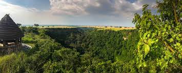
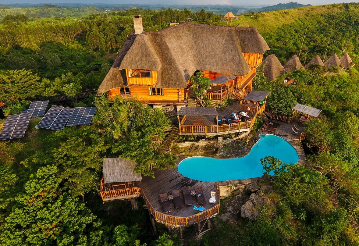
The 207km2 Katonga Wildlife Reserve is a savannah grassland ecosystem located within Kyenjojo and Kamwenge Districts. The journey into the Reserve is a three-hour drive from Kampala to Kyegegwa Town Council. At Kyegegwa, detour southwards for 42 km following well visible signposts.
The Reserve’s terrain is predominantly undulating in nature with distinct vegetation types. Vegetation includes grasslands, wooded grasslands, woodlands, riverine woodlands, swamp, riverine grasslands, papyrus. Most of the area is mixed savannah with acacia or woodland. However, large portions of the reserve are either permanent or seasonal wetlands. The reserve also contains various pockets of riverine and tropical forests. Its unique geographical location between forests, swamps and savannah vegetation gives the reserve a diverse ecosystem that favours the existence of a variety of animal species.
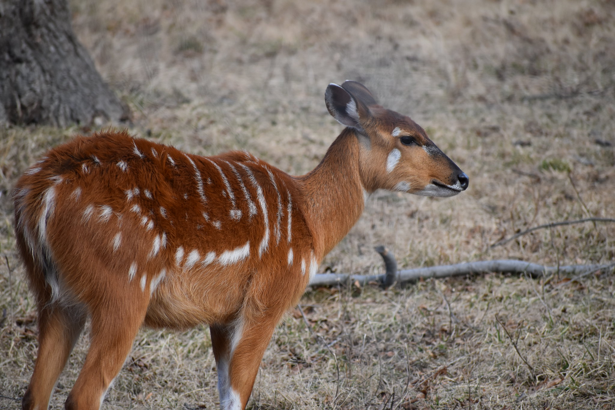
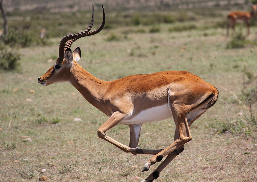
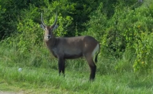
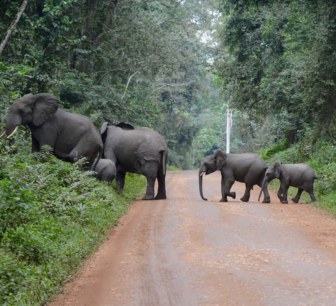
In the 1960s, the reserve was home to a variety of animals including the zebra, topi and eland, which are no longer seen in the reserve. Elephant, buffalo, waterbuck, bushbuck, reedbuck and sitatunga still occur in the reserve. Between 1971 and 1985, most of the wildlife was killed through commercial and subsistence poaching. The reserve was also heavily encroached by cultivators and cattle grazing. In 2014 however, all the encroachers in the park were evicted.
Located in Eastern Uganda, north of Mount Elgon and SOkm east of Scroti. I’SO’-I’IS’N, 34”34”05′-34°50’E. Altitude l,000-3,06Sm Area 231,400ha.
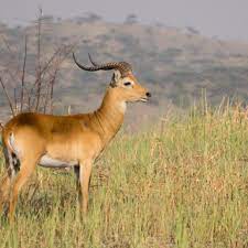
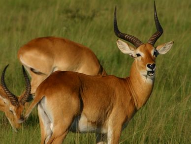
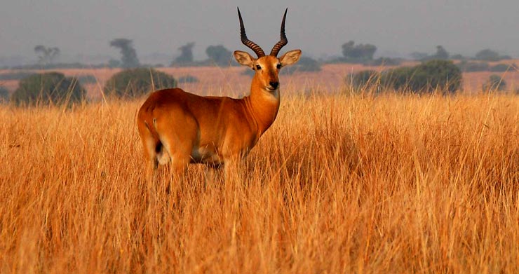
A large variety of mammals in the area include: lion Panthera leo, leopard Pantheia pardus (T), cheetah Acinonyx jubatus (T), giraffe Giraffa camelopardalis, buffalo Syncerus caffer, waterbuck Kobus ellipsiprymnus, Uganda kob Kobus kob, mountain reedbuck Redunca fuhorufula, roan antelope Hippotragus equinus, Jackson’s hartebeest Alcelaphus buselaphusJacksoni, oribi Ourebia ourebi. Most of the eland Taurotragus oryx, topi Damaliscus lunatus, and zebra Eguus quaga borensis migrate into the area to breed from North Bokora and Matheniko reserves and migrate northwards when the rains begin. Birds include ostrich Struthio camelus, secretary bird Sagittarius serpentarius, and yellow-billed shrike Corvinella corvina (uncommon).
Located in South-west Uganda bordering the south-east of the Kazinga Channel and the south shore of Lake George. 0°05’S, 30°05’E. Altitude 700- 1,1 00m Area 15,700ha; contiguous to Queen Elizabeth National Park (197,800ha) and its associated reserves Uganda Land Tenure Government Physical Features The terrain is characterised by small hills and about 10 crater lakes above the east wall of the western Rift Valley (here interrupted by the vast upheaval of the Ruwenzori range). The area also contains a number of swamps. The boundary with Queen Elizabeth National Park is defined by the Kyambura River which flows into the Kazinga Channel. Vegetation Savanna grassland and deciduous thickets
Located in Western Uganda, adjoining Murchison Falls National Park to the north. Approximately r50’N, 3r45’E.
Altitude 900m – 1,300m
Area 675km2 (82,000ha); contiguous to Murchison Falls National Park 3877km2 (384,000ha) and Bugungu Wildlife Reserve 473km2 (52,000ha)
This is an area of gentle relief crossed by several watercourses, south of the Victoria Nile.
The savanna grasslands are dominated by elephant grass Pennisetum purpureurnand Hyparrhenia rufa with isolated forest and savanna trees representing remnants of former forest cover. It is bordered to the south-west by a forested zone.
Species similar to those in Murchison Falls National Park include elephant Loxodonta africana, giraffe Giraffa carrielopardalis, buffalo Syncerus caffer, and many antelope species. Large numbers of animals move in herds to and from Murchison Falls National Park.
Murchison Falls became one of Uganda’s first national parks in 1952
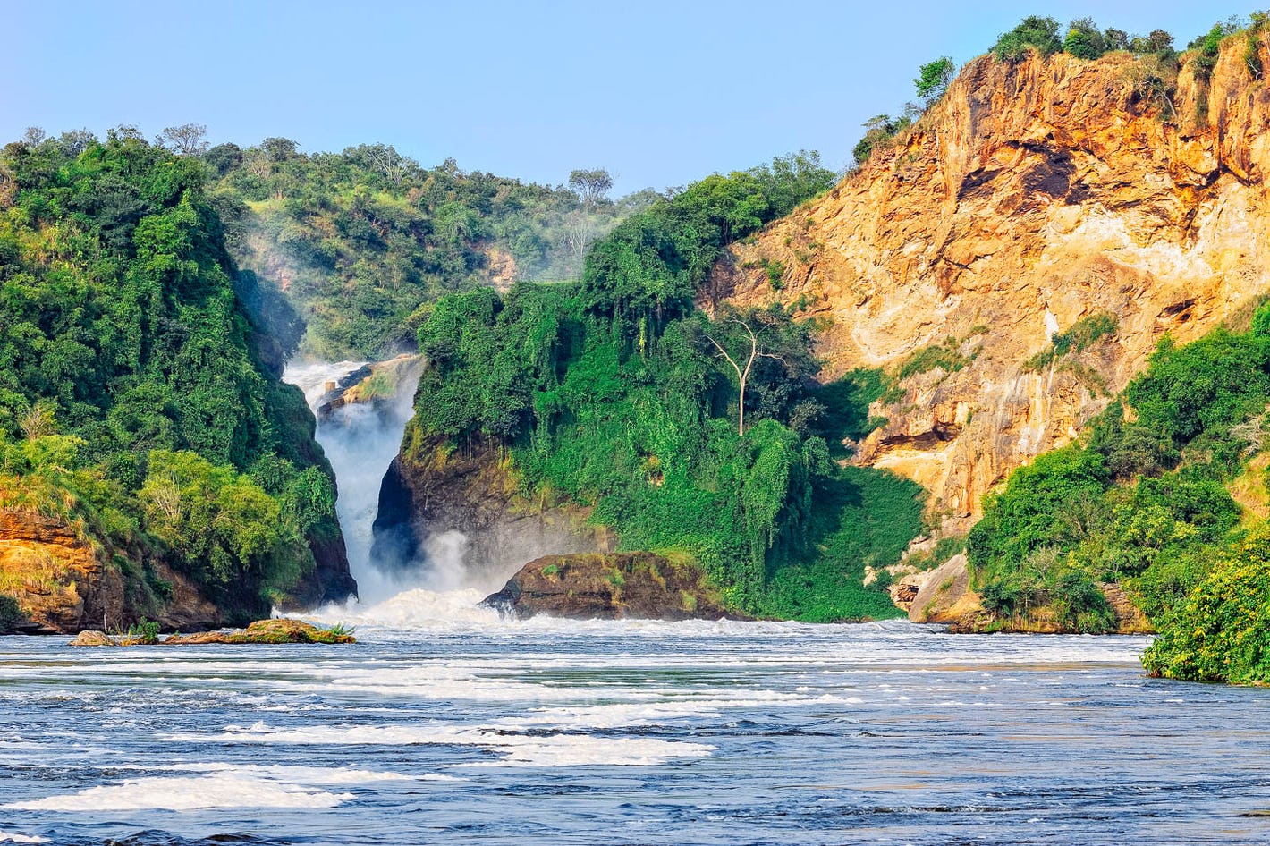
At Murchison Falls, the Nile squeezes through an 8m wide gorge and plunges with a thunderous roar into the “Devil’s Cauldron”, creating a trademark rainbow
The northern section of the park contains savanna and borassus palms, acacia trees and riverine woodland. The south is dominated by woodland and forest patches
The 1951 film “The African Queen” starring Humphrey Bogart was filmed on Lake Albert and the Nile in Murchison Falls National Park.
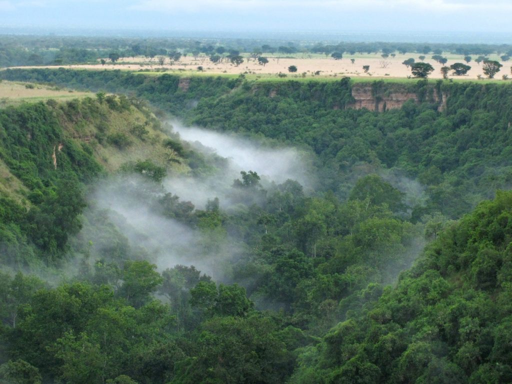
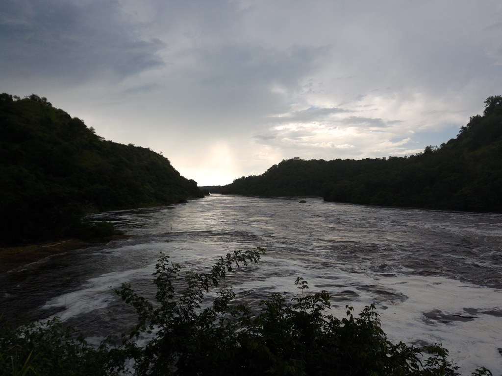
Murchison Falls National Park lies at the northern end of the Albertine Rift Valley, where the sweeping Bunyoro escarpment tumbles into vast, palm-dotted savanna. First gazetted as a game reserve in 1926, it is Uganda’s largest and oldest conservation area, hosting 76 species of mammals and 451 birds.
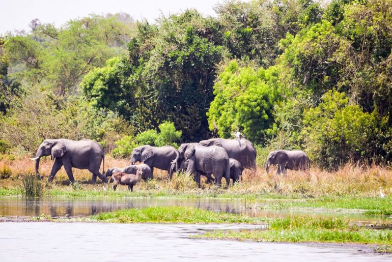
The park is bisected by the Victoria Nile, which plunges 45m over the remnant rift valley wall, creating the dramatic Murchison Falls, the centerpiece of the park and the final event in an 80km stretch of rapids. The mighty cascade drains the last of the river’s energy, transforming it into a broad, placid stream that flows quietly across the rift valley floor into Lake Albert. This stretch of river provides one of Uganda’s most remarkable wildlife spectacles. Regular visitors to the riverbanks include elephants, giraffes and buffaloes; while hippos, Nile crocodiles and aquatic birds are permanent residents.
Notable visitors to the park include Winston Churchill, Theodore Roosevelt, Ernest Hemingway and several British royals.
The park was founded in 1952 as Kazinga National Park, and renamed two years later to commemorate a visit by Queen Elizabeth II.
The Katwe explosion craters mark the park’s highest point at 1,350m above sea level, while the lowest point is at 910m, at Lake Edward.
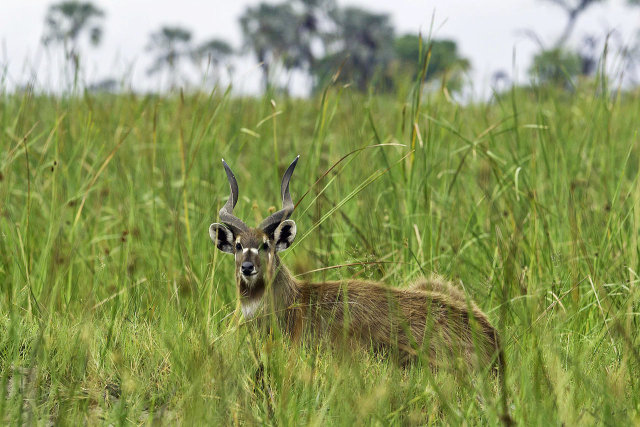
Queen Elizabeth National Park is understandably Uganda’s most popular tourist destination. The park’s diverse ecosystems, which include sprawling savanna, shady, humid forests, sparkling lakes and fertile wetlands, make it the ideal habitat for classic big game, ten primate species including chimpanzees and over 600 species of birds.
Set against the backdrop of the jagged Rwenzori Mountains, the park’s magnificent vistas include dozens of enormous craters carved dramatically into rolling green hills, panoramic views of the Kazinga Channel with its banks lined with hippos, buffalo and elephants, and the endless Ishasha plains, whose fig trees hide lions ready to pounce on herds of unsuspecting Uganda kob.
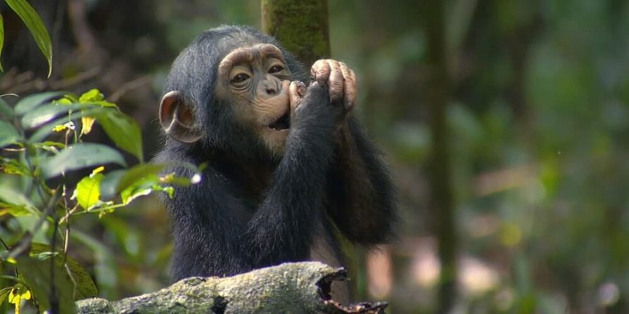
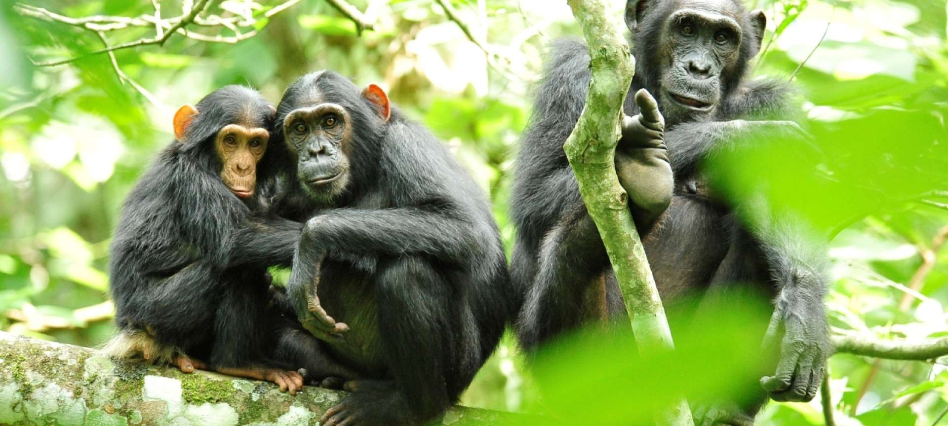
Kibale is one of Africa’s foremost research sites. While many researchers focus on the chimpanzees and other primates found in the park, others are investigating Kibale’s ecosystems, wild pigs and fish species, among other topics.
Kibale National Park contains one of the loveliest and most varied tracts of tropical forest in Uganda. Forest cover, interspersed with patches of grassland and swamp, dominates the northern and central parts of the park on an elevated plateau.
Kibale is famously known for Chimpanzee tracking
The park is home to a total of 70 mammal species, most famously 13 species of primate including the chimpanzee.
The Kibale-Fort Portal area is one of Uganda’s most rewarding destinations to explore. The park lies close to the tranquil Ndali-Kasenda crater area and within half a day’s drive of the Queen Elizabeth, Rwenzori Mountains and Semuliki National Parks, as well as the Toro-Semliki Wildlife Reserve.
The Rwenzoris – the fabled Mountains of the Moon – lie in western Uganda along the Uganda-Congo border. The equatorial snow peaks include the third highest point in Africa, while the lower slopes are blanketed in moorland, bamboo and rich, moist montane forest. Huge tree-heathers and colourful mosses are draped across the mountainside with giant lobelias and “everlasting flowers”, creating an enchanting, fairytale scene.
Rwenzori Mountains National Park protects the highest parts of the 120km-long and 65km-wide Rwenzori mountain range. The national park hosts 70 mammals and 217 bird species including 19 Albertine Rift endemics, as well as some of the world’s rarest vegetation.
The Rwenzoris are a world-class hiking and mountaineering destination. A nine- to twelve-day trek will get skilled climbers to the summit of Margherita – the highest peak – though shorter, non-technical treks are possible to scale the surrounding peaks.
For those who prefer something a little less strenuous, neighboring Bakonzo villages offer nature walks, homestead visits home cultural performances and accommodation, including home-cooked local cuisine.
Kidepo Valley National Park lies in the rugged, semi arid valleys between Uganda’s borders with Sudan and Kenya, some 700km from Kampala. Gazetted as a national park in 1962, it has a profusion of big game and hosts over 77 mammal species as well as around 475 bird species.
Kidepo is Uganda’s most isolated national park, but the few who make the long journey north through the wild frontier region of Karamoja would agree that it is also the most magnificent, for Kidepo ranks among Africa’s finest wildernesses. From Apoka, in the heart of the park, a savannah landscape extends far beyond the gazetted area, towards horizons outlined by distant mountain ranges.
Located in south-western Uganda, at the junction of the plain and mountain forests, Bwindi Park covers 32,000 ha and is known for its exceptional biodiversity, with more than 160 species of trees and over 100 species of ferns. Many types of birds and butterflies can also be found there, as well as many endangered species, including the mountain gorilla.